Syria Health-Care Attack Visualiser
Geospatial analytics system for mapping attacks on healthcare infrastructure
BRIEF
Design and implementation of a geospatial analytics system for mapping and analysing attacks on healthcare infrastructure in Syria using structured OSINT data pipelines and interactive visualisation tools.
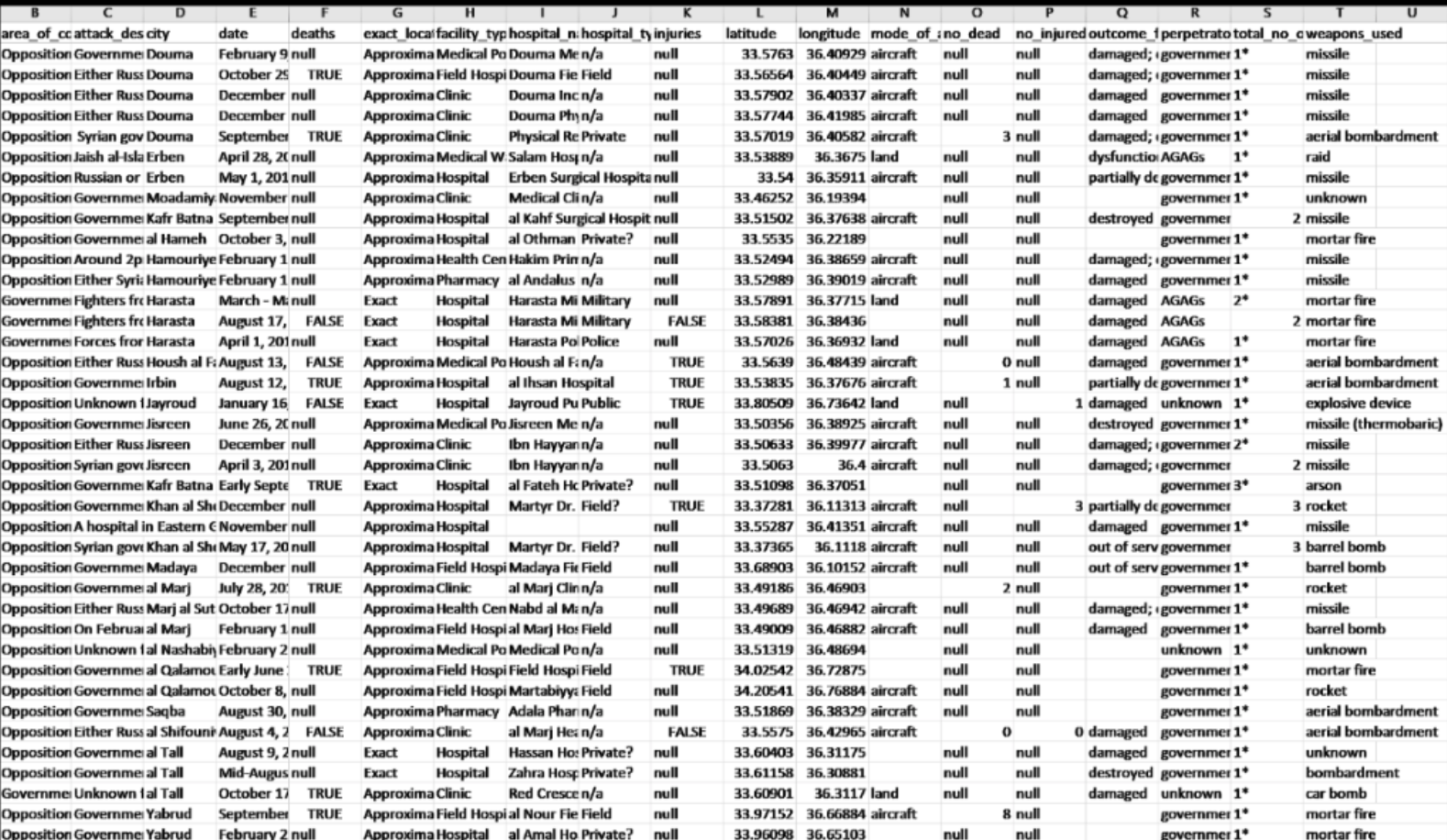
The system followed a modular pipeline encompassing data acquisition, preprocessing, analysis, and visualisation. Incident data was extracted from publicly available humanitarian datasets, open reporting channels, and structured databases through a combination of web scraping and API ingestion.
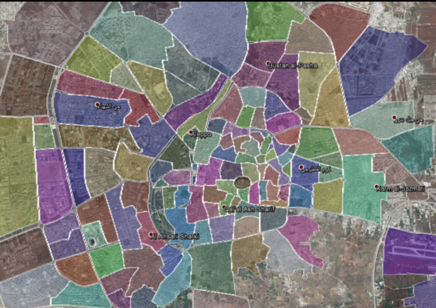
Raw inputs were normalised into geospatial formats through standardisation of timestamps, geocoding of incident locations, and deduplication of overlapping reports. This enabled consistent spatial representation across heterogeneous data sources.
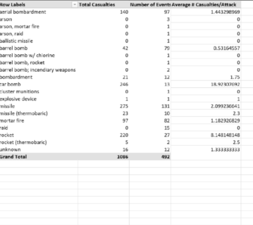
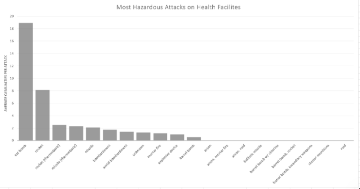
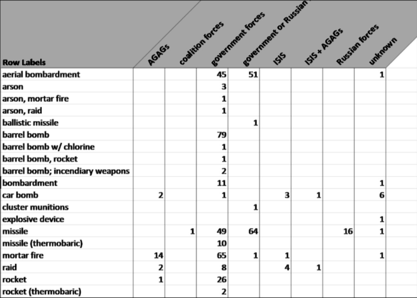
Analytical processing focused on identifying spatial clustering, temporal patterns, and attack modality distributions. Event categorisation allowed for classification of attack types, including conventional strikes and high-casualty incidents such as vehicle-borne explosive events.
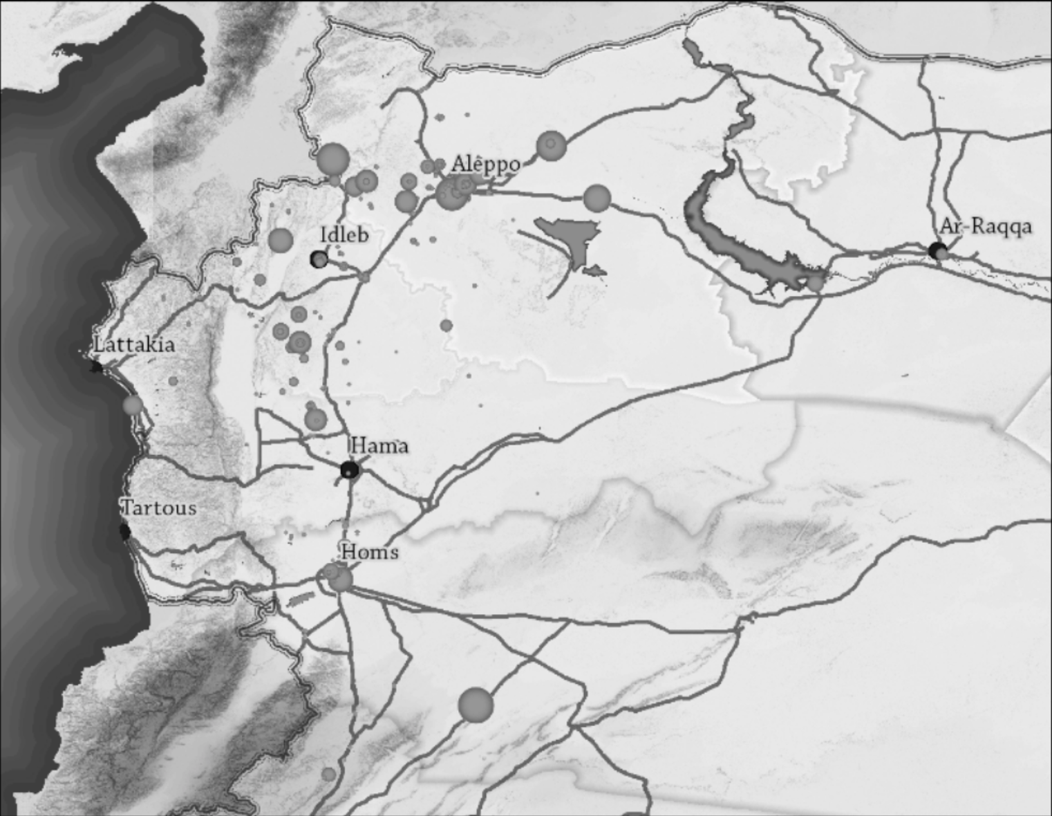
Outputs were rendered as interactive geospatial visualisations, enabling layered exploration of incident density, severity, and distribution patterns across time and geography.
The final system improved interpretability of fragmented conflict reporting by consolidating dispersed datasets into a unified analytical environment suitable for investigative, humanitarian, and policy-oriented use.
OPERATIONAL DETAILS
- >Built modular data pipeline encompassing acquisition, preprocessing, analysis, and visualisation
- >Extracted incident data from humanitarian datasets, open reporting channels, and structured databases
- >Normalised heterogeneous inputs through timestamp standardisation, geocoding, and deduplication
- >Identified spatial clustering, temporal patterns, and attack modality distributions
- >Rendered interactive geospatial visualisations for layered exploration of incident density and severity
TAGS
EXHIBITS